Press release: Flood committee sets out £22million of spending for coming year

A flood and coastal group will oversee spending of almost £22million to protect hundreds of homes across the north east as it sets out its objectives for the next year.

The Northumbria Regional Flood and Coastal Committee (NRFCC) has launched its business plan for 2017/18, which will include continued work at Greatham in Hartlepool, Killingworth in North Tyneside, Hartlepool Headland Coastal Protection Scheme, improvements to the Central Promenade at Whitley Bay, and Monkton Village Flood Alleviation Study in South Tyneside.

It will better protect around 743 properties from flood risk and another 100 from coastal erosion.

It also announced in its 2016/17 annual report that it’s overseen 110 projects costing £24.5million over the past year, reducing the risk of flooding and coastal erosion to 1,291 properties.

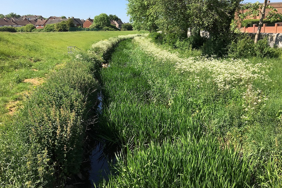
Projects include Lustrum Beck flood alleviation scheme in partnership with Stockton Borough Council which better protects over 150 properties, and the Brunton Park scheme in partnership with Northumbrian Water and Newcastle City Council, which addressed sewer flooding issues and reduces the risk of flooding from the Ouseburn.

And a dam on the Cotting Burn, the final part of the significant £28million Morpeth flood alleviation scheme which protects 1,000 homes and business in the town, was completed.

The dam has been renamed ‘The Hargreaves Dam’ in memory of Jon Hargreaves, NRFCC Chairman who sadly passed away last October.

Images shows Lustrum Beck flood scheme
Lustrum Beck: Raised embankment (L) and new flood wall (R)

Third year of six-year programme

The past year has also seen the completion of a £3million repair programme following the devastating floods during Storm Desmond in December 2015.

The annual report and business plan together summarise the past year and look forward to the year ahead.

It is the third year of a six-year programme of work which was agreed in January 2015. The business plan will be updated each year to take into account any adjustments to the £108million, six-year programme, which will better protect a total of 5,300 properties once complete.

Leila Huntington, Flood and Coastal Risk Manager with the Environment Agency in the North East, said:

On completion of our £22million programme of work for the coming year, we will see a reduction in flood and coastal risk to around 843 homes and businesses in the region, as well as creating 30 hectares of new water dependent wildlife habitat.

The committee is a great example of true partnership working, with all local councils, the Environment Agency and Northumbrian Water pulling together on behalf of communities in the north east.

It has an essential role to play in developing and completing flood risk management projects which reflect local priorities and understand the needs of communities.

This is the third year of our six-year programme – so far we have already better protected 2,045 properties, bringing significant benefits to communities, properties, businesses and the environment, and this work will continue.

Image shows Brunton Park flood scheme, the new River Ouseburn Channel
Brunton Park: Northumbrian Water’s Paul Davison (L) and the Environment Agency’s Phil Welton (R) at the new River Ouseburn channel.

Partnership working

Most projects in the plan are carried out by the Environment Agency and local authorities, with some carried out by, or in partnership with Northumbrian Water.

Councillor Nick Oliver, Northumberland County Council’s NRFCC member, said:

The Morpeth scheme is a great example of agencies working together on a hugely ambitious engineering project and the fact it has already been used more than proves its worth.

One of the cornerstones of the scheme has been the help and support of the local community, and their input and engagement has been absolutely invaluable throughout.

In Northumberland we are only too aware of the devastating effects of flooding and we welcome this latest plan which details continuing investment in schemes to protect communities across the region.

The Brunton Park scheme, which was completed last year, involved creating a new river channel to divert the River Ouseburn and, by using the old channel as a new storage basin, creating a valuable habitat for wildlife. It also involved the construction of flood defences, the installation of two kilometres of new sewer pipe and a new storage tank.

Richard Warneford, Northumbrian Water Group’s Wastewater Director, said:

Tackling flooding and improving the resilience of our sewer network are key priorities for us. We know that being flooded is a truly awful experience for our customers and we work tirelessly to reduce the risk of this happening. By working in partnership with the Environment Agency and local authorities we can tackle flooding from all sources.

The Brunton Park scheme is an excellent example of partnership work. By drawing upon the experience and expertise of all our partners, an innovative and creative solution was agreed that enabled us to manage surface water in the natural environment.

I am extremely proud of our partnership approach which resulted in reducing the risk of flooding to our customers and the community. We will certainly be able to build on the experience of delivering this project for future schemes.

The NRFCC receives funding from a variety of sources, including from Government Grant-in-Aid, public and private contributions and a levy raised through local authorities.

The committee consists of elected and independent members and plays an important part in deciding local priorities for the flood and coastal risk management programme in North East England.

Anyone who would like a copy of the business plan and annual report can email nrfcc@environment-agency.gov.uk


Press release: Happy Dace for north east fish surveys

The Environment Agency has joined forces with expert anglers to carry out an important survey to assess the numbers of a highly prized fish in Northumberland.

Surveys for Dace, the main species of coarse fish in the River Tyne, much valued by anglers, took place downstream of Kielder reservoir as part of a wider programme to monitor any impact of the current trial of changes in the release of water from the reservoir.

Environment Agency specialists teamed up with 15 expert anglers from the Tyne Anglers Alliance and other fishing clubs to fish around a dozen locations on the North Tyne between Kielder and Watersmeet.

The aim was to both update and enhance our existing information on Dace populations.

Image shows one of the Dace caught in the survey
One of the Dace surveyed during the event

Successful survey

Environment Agency Fisheries Officer Niall Cook, who organised the survey, said:

Angling was used in the survey in preference to other survey methods like electric fishing and netting because dace are highly mobile and difficult to catch, especially in wide rivers like the North Tyne.

The angling survey itself was really successful in that it showed dace to be present throughout the river system and in areas where they had not been recorded for many years, such as Falstone. We are hoping to repeat the exercise over several years or more to build up a more detailed picture.

The Environment Agency, Northumbrian Water and the hydropower operator, Innogy Renewables UK Ltd have been working together to make changes to the operating arrangements for the release of water from Kielder reservoir.

The trial started in November last year and is intended to maintain the future of water supply to the North East, better reflect the natural changes in river flows, provide increased flood storage in the reservoir and increase the generation of clean, renewable energy.

The rainfall over the winter trial period was low and large flood alleviation releases were not required, so the initial results were inconclusive.

As a result the trial has been extended through the summer and will be continually reviewed.

Image shows an angler taking part in the survey
An angler taking part in the Dace survey

More natural flow variation

Hydrologist Rachel Merrix, who is leading on the trial for the Environment Agency, said:

We were keen to use this opportunity to change the releases from Kielder to try to make them reflect a more natural flow variation. While the changes are relatively minor we believe that monitoring is essential to ensure the environment is protected.

We have worked hard with our partners to listen to the views of both reservoir and river users, including holding a public drop-in last October ahead of the trial, and producing a freely available interim report.

We welcome feedback from anyone who uses the river or reservoir and are keen to hear how others feel the trial is going. We continuously monitor river levels, flows and water temperatures at several locations in the Tyne catchment and all of this data is available on request.

Other activities to monitor the impact of the new Kielder release regime include temperature monitoring at 11 new sites as well as fishing surveys and freshwater pearl mussel assessments.

For more information and updates on the trial visit the dedicated Kielder release website or email Kielder.reservoir@environment-agency.gov.uk with any queries or observations.


Press release: Councillors see plans for reducing flooding in Mytholmroyd

A guided walking tour of Mytholmroyd to share plans for the new £30m flood alleviation scheme proposed for the village has been hosted for ward councillors.

They were invited to meet the Environment Agency’s project team on Friday 18 August to share their plans for the project on site and ask any questions.

Mark Tupman, senior advisor with the Environment Agency, said:

Our aim is to explain to the local councillors, who represent the people of Mytholmroyd, our plans for the scheme so that they fully understand the timing of various activities and have a point of contact throughout the two-year project.

We would like to give them an opportunity to ask any questions and raise any concerns and see first- hand the plans by taking a walk around the site.

The Calderdale Flood Partnership Board recently approved the allocation of funding of the major flood scheme to improve the protection for homes and businesses in Mytholmroyd

The Environment Agency will be submitting a series of submissions for planning permission this week, with further submissions planned for September and construction is expected to commence in the Autumn.

The scheme for Mytholmroyd has been developed in partnership with Calderdale Council, the local community, and partners. As design work is finalised, the current options for the scheme include:

  • New, raised flood and improved walls
  • The relocation of Caldene Bridge
  • Widening of the river channel at key locations
  • Strengthening and waterproofing of buildings next to the river.

The Leader of Calderdale Council, Cllr Tim Swift, said:

The works in Mytholmroyd are part of an ongoing programme to reduce the risk of flooding across Calderdale.
We’re keen for people in the local community to keep up to date with the work, which they can do by visiting www.eyeoncalderdale.com or popping in to the Mytholmroyd flood information centre during opening hours.

The second phase of a demolition is currently being carried out at a site on the main A646 Burnley road through the village which is expected to take a further six weeks. This involves demolishing three two-storey buildings, including a former post office, which has been relocated to the nearby Grange Dene complex.

The demolition of the buildings is being done carefully in order to deal with the constraints associated with their proximity to the highway, the river, and the fact they are within a conservation area. Historic England, the Environment Agency and Calderdale Council are all keen that the stone is re-used. The properties are being demolished to prevent any further collapse during another flood event.

Plans are for the scheme to be completed in phases and widening the river at Greenhill Industrial Estate will continue to be explored.

A flood information centre is open in the village offering the public advice on flood resilience and the opportunity to speak to Environment Agency staff about plans for flood schemes in Calderdale.

Following the flooding of December 2015, the Environment Agency has completed six new schemes, reducing flood risk to 500 homes as part of a £9million recovery programme across Calderdale. In Mytholmroyd, significant work to clear the channel, repair damaged walls and make safe damaged buildings has already been carried out.