


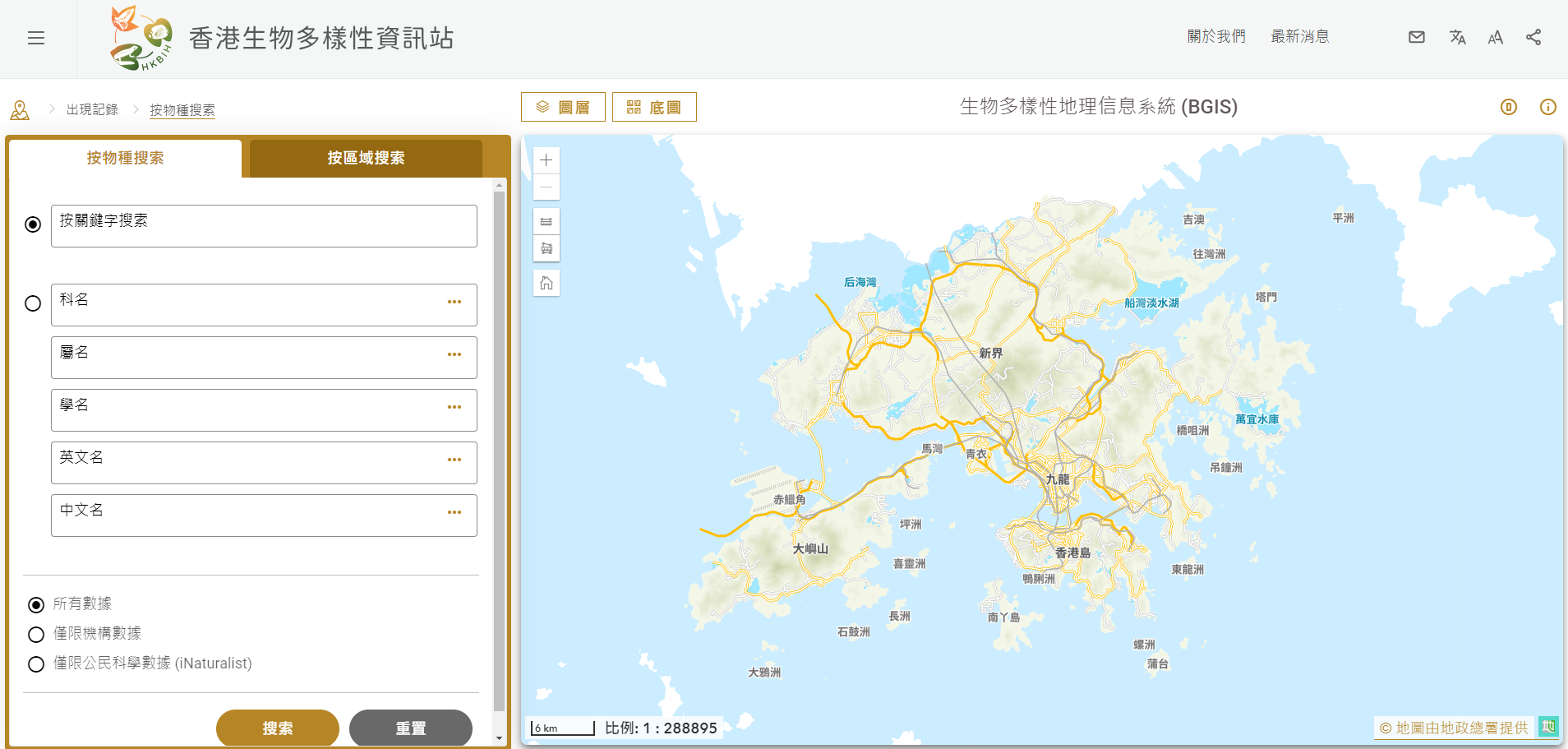
The Agriculture, Fisheries and Conservation Department (AFCD) officially launched the Biodiversity Geographic Information System (BGIS) (bih.gov.hk/en/bgis/index.html) today (January 17). The BGIS aims to provide a one-stop platform to enable the public to gain a better understanding of the diverse species found in Hong Kong.
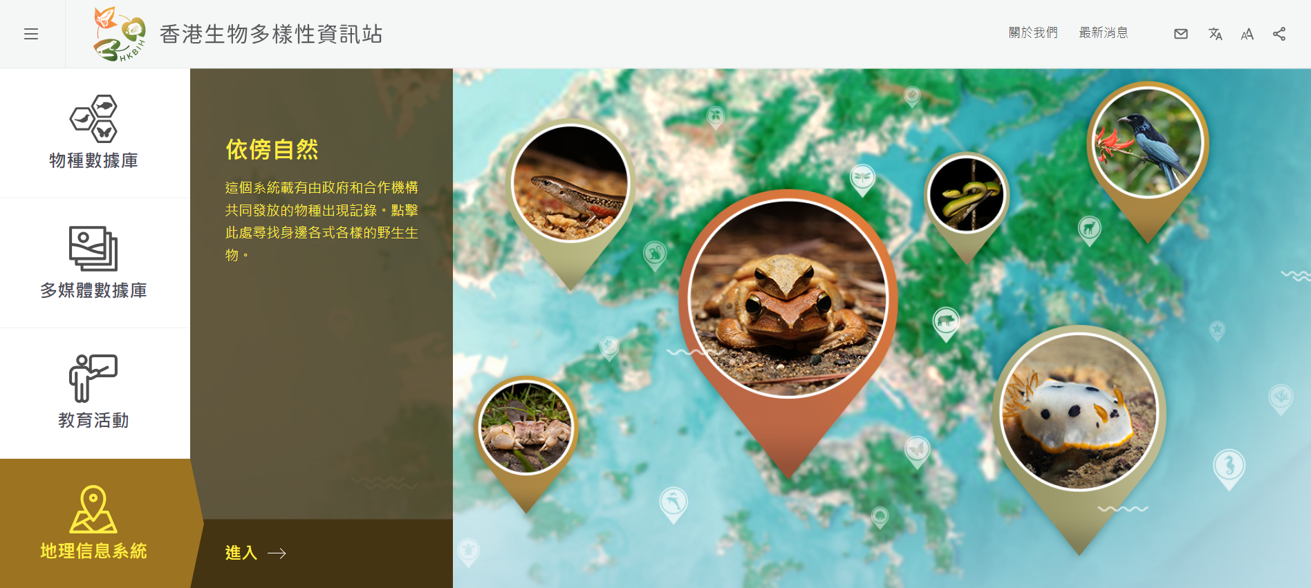
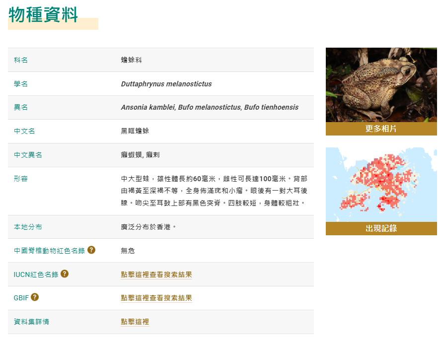
The BGIS is the second development phase of the Hong Kong Biodiversity Information Hub (HKBIH), an initiative under the Hong Kong Biodiversity Strategy and Action Plan (BSAP) to facilitate capacity building and knowledge sharing. The BGIS contains more than a million occurrence records of local species compiled by the AFCD, its partner organisations, and scientific research and citizen science projects at present. The BGIS is also linked to other databases in the HKBIH, which include the species database and multimedia database featuring information and photos of various species. The new BGIS features a "search by area" function which allows the public to search not only by species name but also to find local species based on geographical location.
Since the launch of the HKBIH in 2022, new data and information have been updated and added continuously, with over 10,000 visits recorded each month. The newly launched BGIS will further enrich the content of the HKBIH and enhance public understanding of local biodiversity. The AFCD will continue to engage more partner organisations to contribute to the HKBIH during the BSAP implementation in the future, and also organise relevant citizen science activities to enable the public to participate in data collection and knowledge sharing to promote biodiversity conservation.
Follow this news feed: East Asia